Have you ever wondered how we know where to find water, minerals, or even the best places to build roads and houses? The answer lies in maps, and the people who create them are called, cartographers. A cartographer’s role may include analysing geographic data like population density, weather patterns, and land use.
Cartography is the skill of making maps. It involves using science, technology, and art to create visual representations of the Earth’s surface on paper or a screen (digital and interactive maps). Cartographers, the mapmakers, combine geography, design, and technology to create maps that help us understand where places are or where things are on Earth, how to get there, and help us make informed decisions. These maps can show everything from mountains and rivers to population density, navigational charts, or economic activity and climate patterns. Each of these maps (e.g. Archaeological maps, Geological maps, Topographic maps, Globes, Maritime charts, Military maps, Road atlases, Statistical maps, and Tourist maps) serves different purposes, from helping researchers understand the environment and to guide decision-makers on resource management.
What environment do cartographers work in?
Cartographers typically work for ministries or government agencies, private companies (management or technical consulting services, utilities, as well as architectural or engineering services), NGOs or academic institutions. Overall, the work environment of a cartographer is primarily indoors but can involve occasional fieldwork to gather data and ensure the accuracy of their work.
What does a Cartographer do at the Ministry of Mines and Energy?
Cartographers at the Geological Survey of Namibia are essential in translating complex geological data into visually appealing maps, enhancing our understanding of our country’s specific geology. Here are some of their key responsibilities:
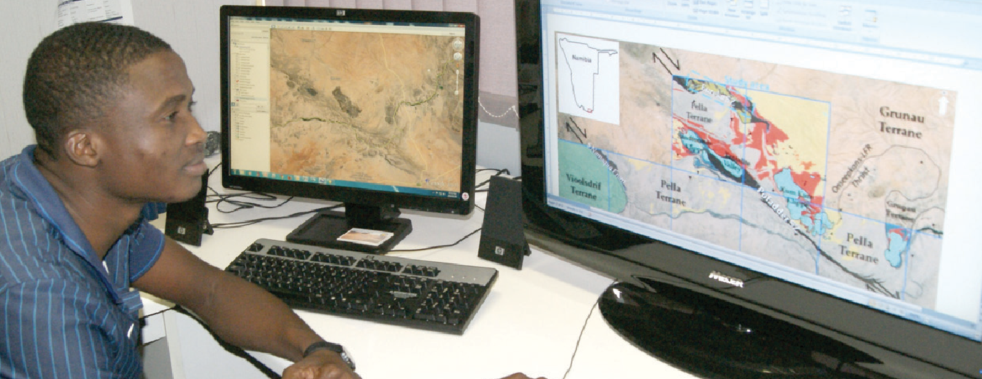
- Gather information and analyse data: They collect data from various sources, like draft geoscience maps, old geological, satellite images and field studies. They study this data to understand patterns and trends in the earth’s surface.
- Design and create maps: Using special software, cartographers design and create detailed or generalised maps that show different geological features, including features like rock formations, fault lines, and mineral deposits. They also create thematic maps that highlight specific geological phenomena, such as rock types and geohazard, geophysical, geochemical or seismic activity.
- Visualize data: They use colours, symbols, and labels to make these maps clear and easy to read.
- Share the maps and information: They produce both physical and digital maps, making them accessible to a wider audience.
- Collaboration: Cartographers work closely with geologists, geophysics, and other experts to ensure the accuracy and relevance of the maps.
Cartographers at the Geological Survey of Namibia take complex geological information, like where to find minerals, groundwater or the history of earthquakes, and turn it into easy-to-understand maps. These maps help scientists, engineers, farmers, and even regular people understand the earth’s history, find valuable resources, and plan better. By creating these maps, cartographers help us understand our country’s specific geology better and make informed decisions.
Becoming a Cartographer
To become a cartographer, you would typically need a qualification in spatial or geographical sciences. If you are a high school student thinking about this career path, focusing on subjects like mathematics, geography, mechanical drawing, and computer science can be a great start. You may also need to learn programming languages such as Python or JavaScript, which are used for creating web maps and conducting spatial analysis.
Cartography is a fascinating field that combines the best of science, technology, and creativity. If you are curious about how maps are made or how they help us manage our resources, this could be a rewarding career choice.
Together, we are harnessing Namibia’s natural resources to power our future.
Harnessing Our Resources, Powering Our Future.